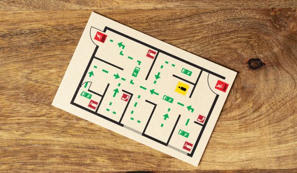
Why Static Floor Plans Are No Longer Enough
Dynamic digital indoor mapping platforms provide real-time situational awareness by replacing out-of-date paper plans with interactive building layouts accessible to all responders.
- By Brian McIlravey
- September 18, 2026
The future of campus safety means embracing a shift towards dynamic digital indoor mapping platforms that provide real-time readiness and situational awareness.
Walk into almost any campus security office and you'll notice binders of printed floor plans on the shelf. Likely, some campus map PDFs are saved to a local drive. Architectural drawings from recent renovations. Maybe a wall-mounted map from an online map provider showing buildings as they looked five years ago.
These documents have been the backbone of emergency and incident pre-planning for decades. But when an incident occurs at 3 a.m. at a 40-building campus, they are not what teams reach for. And if they do reach for them, they often find out-of-date information.
Campus emergency response has outgrown static floor plans. The good news is that the indoor mapping technology to replace them already exists, and it's being adopted by the security and public safety teams that need it most.
The Problem with What's on the Shelf
College, healthcare and corporate campuses do not consist of single buildings. They are collections of buildings that change constantly. Wings get added. Rooms get repurposed. Tenants move in and out. A floor plan that was accurate a few months ago may bear little resemblance to the space today, let alone the floor plan from a few years ago.
Static maps and reference materials struggle in three ways:
- They go out of date quickly. Most campuses do not have a central process for updating maps after every renovation or layout change that multiple teams or departments share. If they do make them available, they are usually limited to PDF or complicated CAD files.
- They are difficult to access in a moment of crisis. Printed binders sit in offices that are locked after hours. PDFs are hidden in folders behind locked computers. First responders arriving on-site do not have time to dig for maps.
- They cannot be shared in real time. A static document cannot show where an alarm is firing right now. It cannot update when a locked door is forced open, or a camera detects motion in a restricted area.
Response tactics depend on whoever happens to know the campus or buildings the best. Where every second counts, that may provide an inconsistent level of safety and security.
What Dynamic Indoor Mapping Changes
The shift happening across campus security is a move towards live, easy to access on any device, interactive indoor mapping that covers every floor or every building, even restricted and outdoor spaces. Think of it as a single source of truth for what's inside every building, kept current, and accessible to anyone with permission.
A few things become possible when that foundational map is in place:
- Security teams and responders see the same map. Campus security and local fire or police departments all view the same building maps from the same source.
- Triggers get a location, not just an ID. When an alarm is triggered, it can be found exactly in a room, a floor and a stairwell, not a device number that a dispatcher must figure out and decipher.
- Pre-planning becomes essential. Fire crews can review building interiors before they ever respond to that campus. They know where the emergency equipment is found, entry and egress locations, shutoff valves, hazardous materials in chemistry labs, and how to reach the roof.
- Updates happen continuously. When a building changes, the map changes with it. Facilities, operations, and administration are all on the same page. There is no waiting for the next annual refresh.
Indoor mapping platforms do not replace the security stack a campus has already invested in. Video management, access control, mass notification and dispatch software all keep doing what they do. The indoor map sits underneath them and gives every alert, every camera feed, and every dispatched responder a location they can find or navigate to.
What This Looks Like in Practice
Picture the same 3 a.m. scenario, but with a live indoor map in place. A silent alarm triggers in the research building, indicating an active threat. Is it a break-in or an intruder with a weapon?
The campus security operations center immediately sees the location of the breach on the digital indoor map, can view the nearest camera feeds, and determine the status of nearby access control points. Local police, dispatched to the scene, access the same live map on their mobile devices while enroute. With updates from the security team, police can know the exact floor or room, find the nearest entry and exit points, and understand the threat with video footage, allowing them to coordinate their tactical approach with precision before even arriving on-site.
The team is not searching; they are acting to neutralize the threat and secure the building.
That is the difference between detection and response. Detection tells you something happened. Response requires location, context and the ability to act on both.
Where Campus Security Goes from Here
Most campus security leaders already know their static documents are a weak link. The harder question is what to do about it. Fortunately, the answer does not require ripping out existing systems. It requires adding a foundational layer that makes those systems work better together and gives every responder, internal or external, the same accurate view of the building.
Static floor plans had a long run. But the buildings they describe have changed, and the threats facing them have changed too. The response tools need to catch up.
When a security incident occurs, there should be no doubt about where it is located.
Remember, it is not just a floor plan anymore; it is a life-safety tool.
This article originally appeared in the September/October 2026 issue of Campus Security Today.